[View 9x enlarged (245K) version]
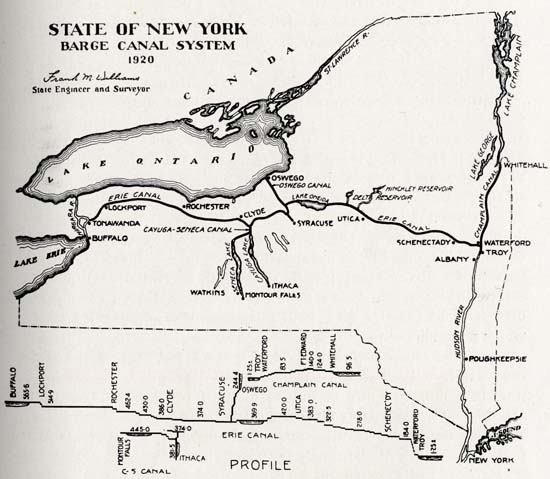
Showing the main trunk lines; the Erie division, running from Waterford to Albany; the Oswego division, running from Syracuse to Oswego; the Champlain division, running from Waterford to Whitehall; the Cayuga and Seneca branch from the Seneca river to Geneva on Seneca lake.
Place names on map (roughly west to east) include Niagara River, Buffalo, Tonawanda, Lockport, Lake Ontario, St. Lawrence River, Erie Canal, Rochester, Clyde, Cayuga-Seneca Canal, Watkins, Seneca Lake, Cayuga Lake, Montour Falls, Ithaca, Oswego, Oswego Canal, Lake Oneida, Syracuse, Utica, Delta Reservoir, Hinckley Reservoir, Schenectady, Albany, Waterford, Troy, Champlain Canal, Whitehall, Lake George, Lake Champlain, Hudson River, Poughkeepsie, Long Island Sound, New York [City]
The "Profile" section shows the following place names and depths:
Erie Canal: Buffalo 565.6, Lockport 514.9, Rochester 462.4, 430.0, Clyde 386.0, 374.0, Syracuse, 369.9, 420.0, Utica 383.0, 322.5, 278.0, Schenectady, 184.0, Waterford, Troy, 1.25 +/-
Cayuga-Seneca Canal: Montour Falls 445.0, 381.5, Ithaca 374.0
Champlain Canal: 1.25 +/-, Troy, Waterford, 83.5, Fort Edward 140.0, 124.0, Whitehall, 96.5